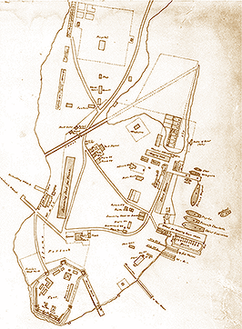
 Contemporary sketch map of the Naval dockyard illustrating the dockyard fence and the location of the sentry posts.
The end of the American Revolution produced the strategic need for new Anglo-Canadian naval and military positions. Consequently, in 1783, a small British Army garrison was established at Cataraqui (now Kingston) and a new government wharf with naval storage was built on the east shore of Point Frederick. Six years later, Point Frederick became the main Provincial Marine depot when it was relocated from its former base on Carleton Island (south of Wolfe Island), which had been ceded to the Americans. Under the Army's Quartermaster-General's Department, the Provincial Marine soon built armed transport schooners. At the outbreak of war in June 1812, the Naval Base consisted of a blockhouse, storage, dockage, and construction facilities. There were also two corvettes, three armed schooners, some gunboats, and 230 naval personnel and a 100-man army garrison in the area. When the Royal Navy assumed command in early 1813, a wooden fence was built to separate the growing Dockyard from the town and the labourers' shanties. While the current gate and stone wall were erected after the war, being part of an 1815 plan which included a gatehouse, earlier drawings clearly show a sentry post and gate in this area.
Walking Tour
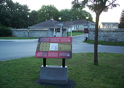
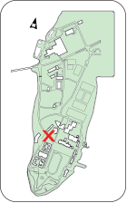 Panel 9 is located at the intersection of Valour Drive and Point Frederick Drive, facing the Dockyard gate and the former guard house.